Can you spot the endangered animals in these illustrated maps?
Tricky to spot but rewarding to find.
Daily design news, reviews, how-tos and more, as picked by the editors.
You are now subscribed
Your newsletter sign-up was successful
Want to add more newsletters?

Five times a week
CreativeBloq
Your daily dose of creative inspiration: unmissable art, design and tech news, reviews, expert commentary and buying advice.

Once a week
By Design
The design newsletter from Creative Bloq, bringing you the latest news and inspiration from the worlds of graphic design, branding, typography and more.
Once a week
State of the Art
Our digital art newsletter is your go-to source for the latest news, trends, and inspiration from the worlds of art, illustration, 3D modelling, game design, animation, and beyond.

Seasonal (around events)
Brand Impact Awards
Make an impression. Sign up to learn more about this prestigious award scheme, which celebrates the best of branding.
Inspired by the hidden map figures of Switzerland's Swisstopo cartographers, Hawaiian Islands has created a series of illustrated US maps with elusive easter eggs, each disguising an animal facing extinction. Upcoming illustration trends suggest that art with an activist touch will gain popularity in the new year and these intricate illustrations are a shining example of playful artistry with an important message.
The team at Hawaii Islands commissioned creative studio NeoMan to create illustrations featuring five endangered creatures. The designs use a range of cartographical styles ranging from flat design to detailed relief shaded maps, uniquely integrating each animal illustration. Some blend into the intricate gradient linework while others are shaped into the land, making them tricky to spot but rewarding to find – see if you can spot them all.
01. Black-footed ferret
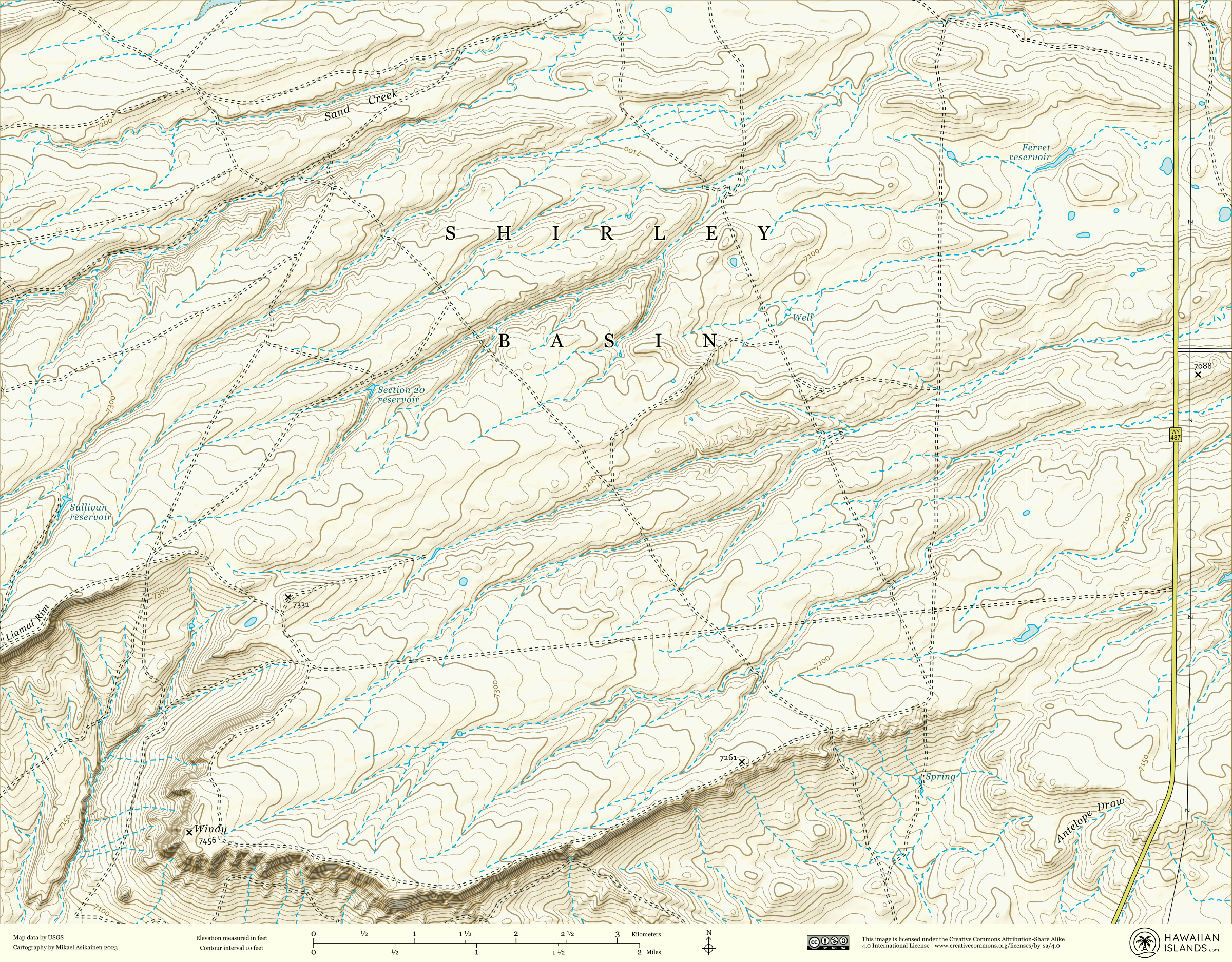
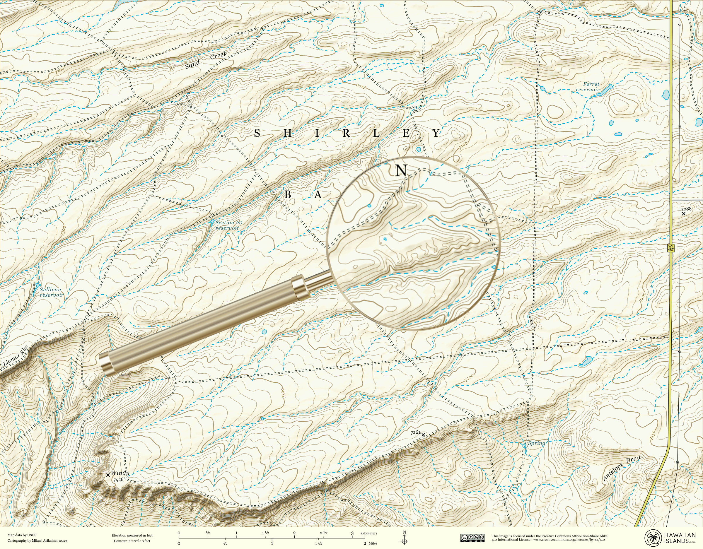
Due to farming of the ferret's native prairie habitat, numbers of the black-footed species have been dwindling. Black-footed ferret populations in the wild are now predominantly the result of rewilding efforts.
02. California condor
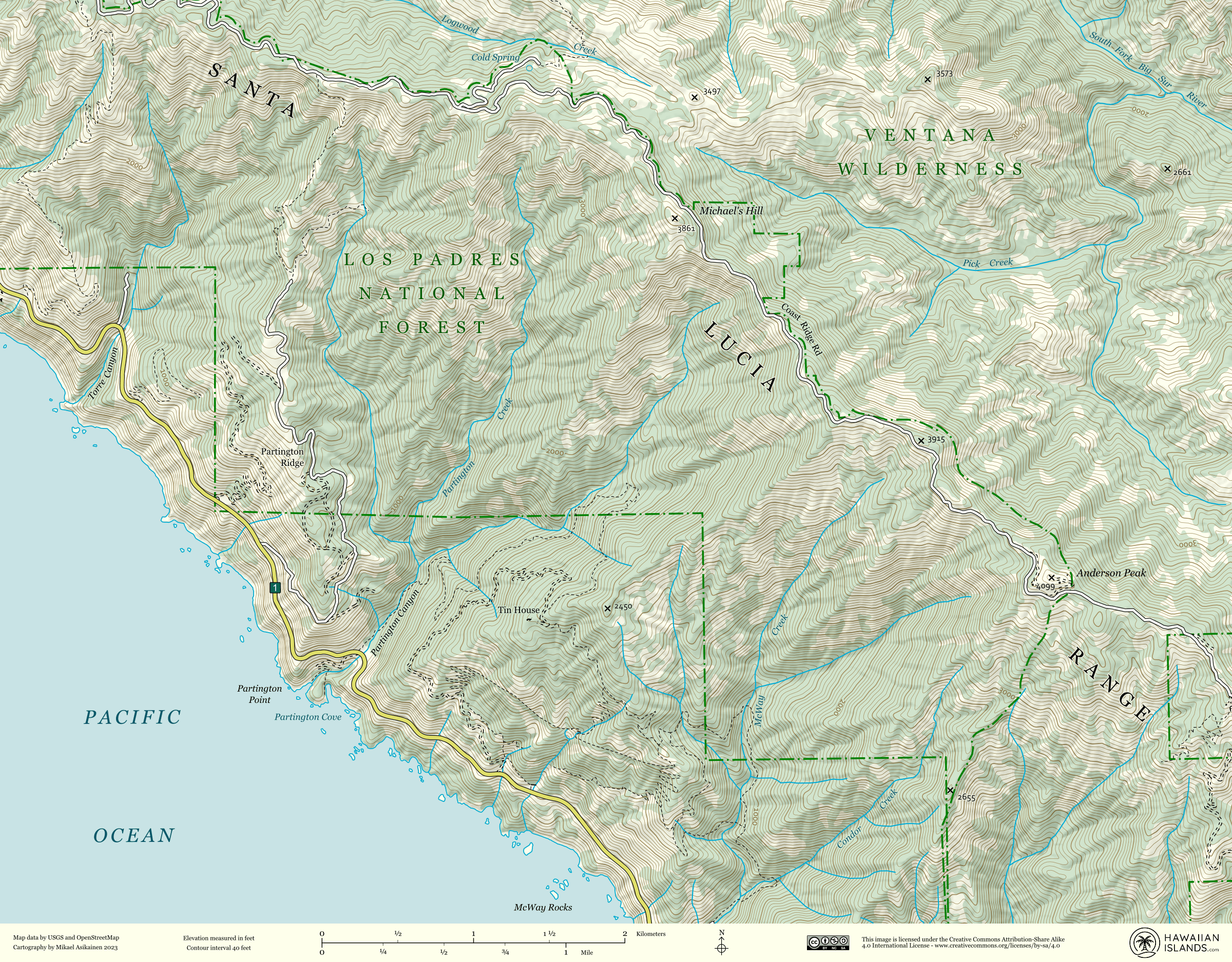
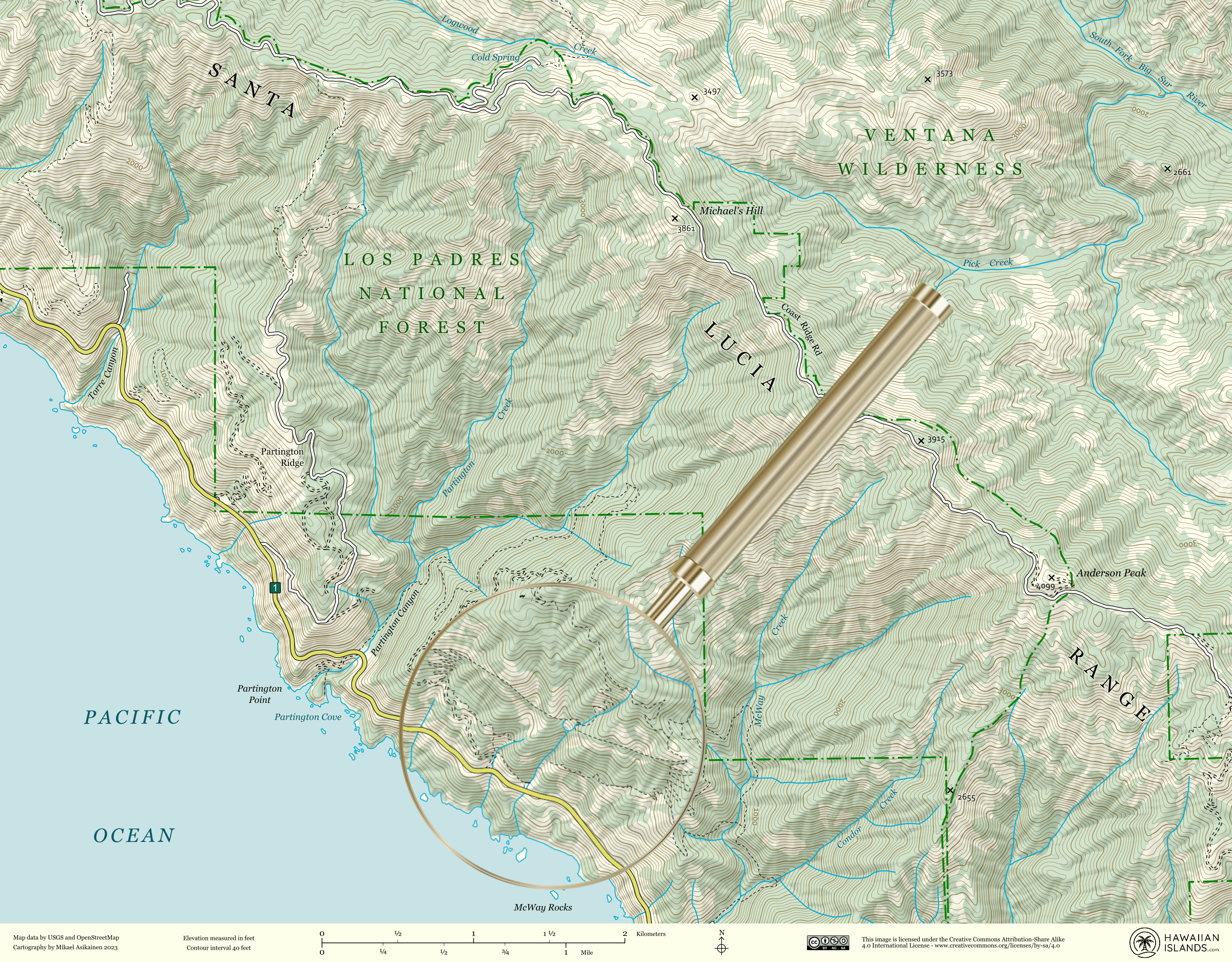
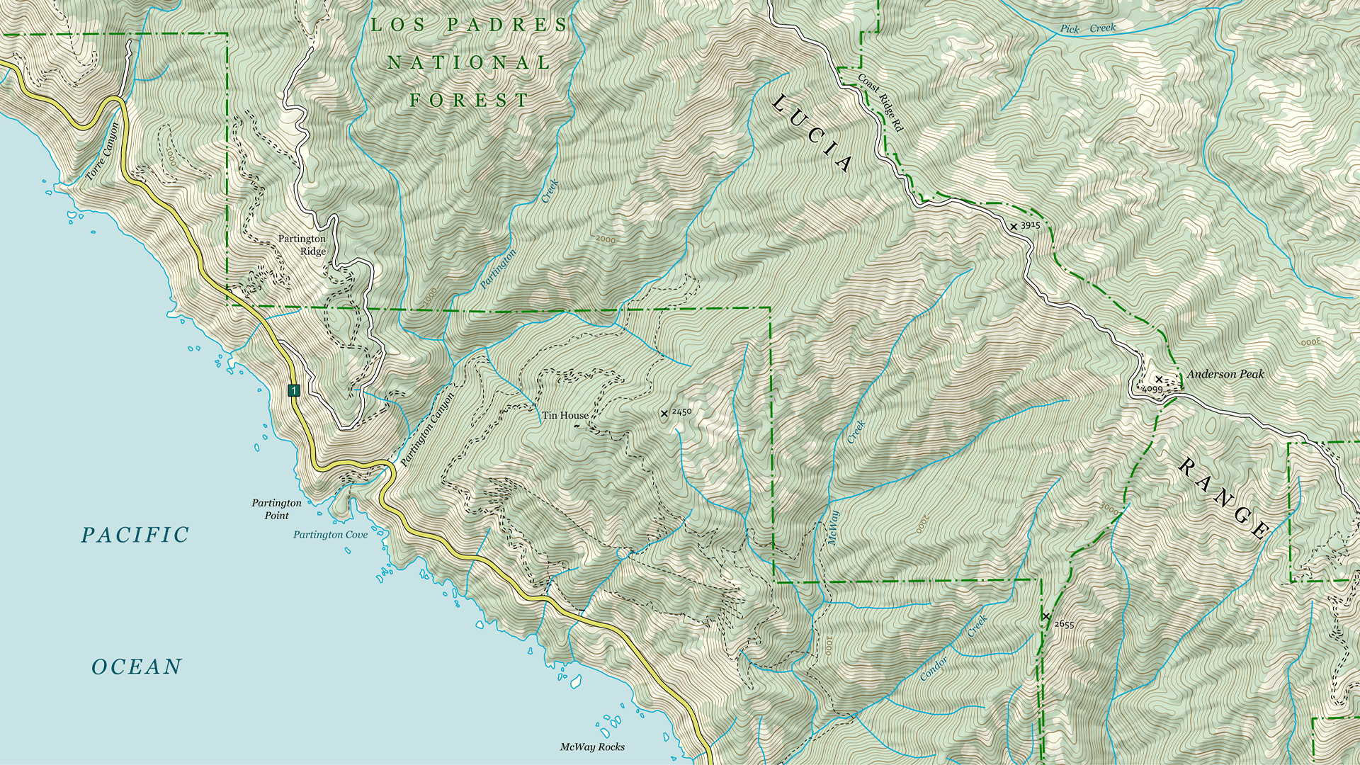
The California Condor is North America's largest land bird. Since their critical endangerment status, the birds have been reintroduced into the wild, particularly in the mountainous areas of southern California.
03. Florida panther
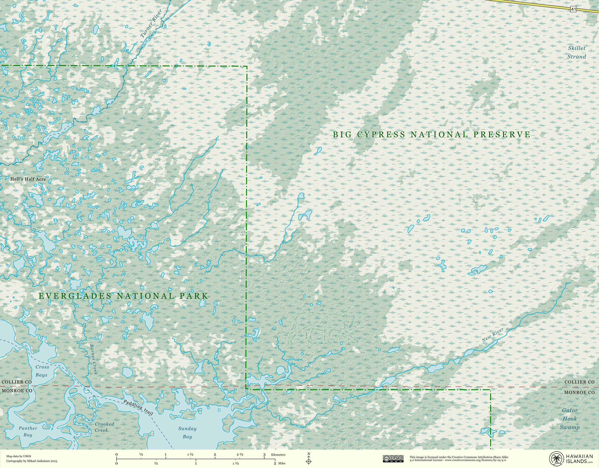
The Florida panther prefers a dense habitat in which they can hide and hunt prey, as well as raise their young, but due to habitat loss, their numbers have significantly dwindled. Visitors to the Fakahatchee Strand Preserve State Park may be lucky enough to see one of these elusive endangered beasts in the wild thanks to over 77,000 acres of protected habitat.
04. Loggerhead sea turtle
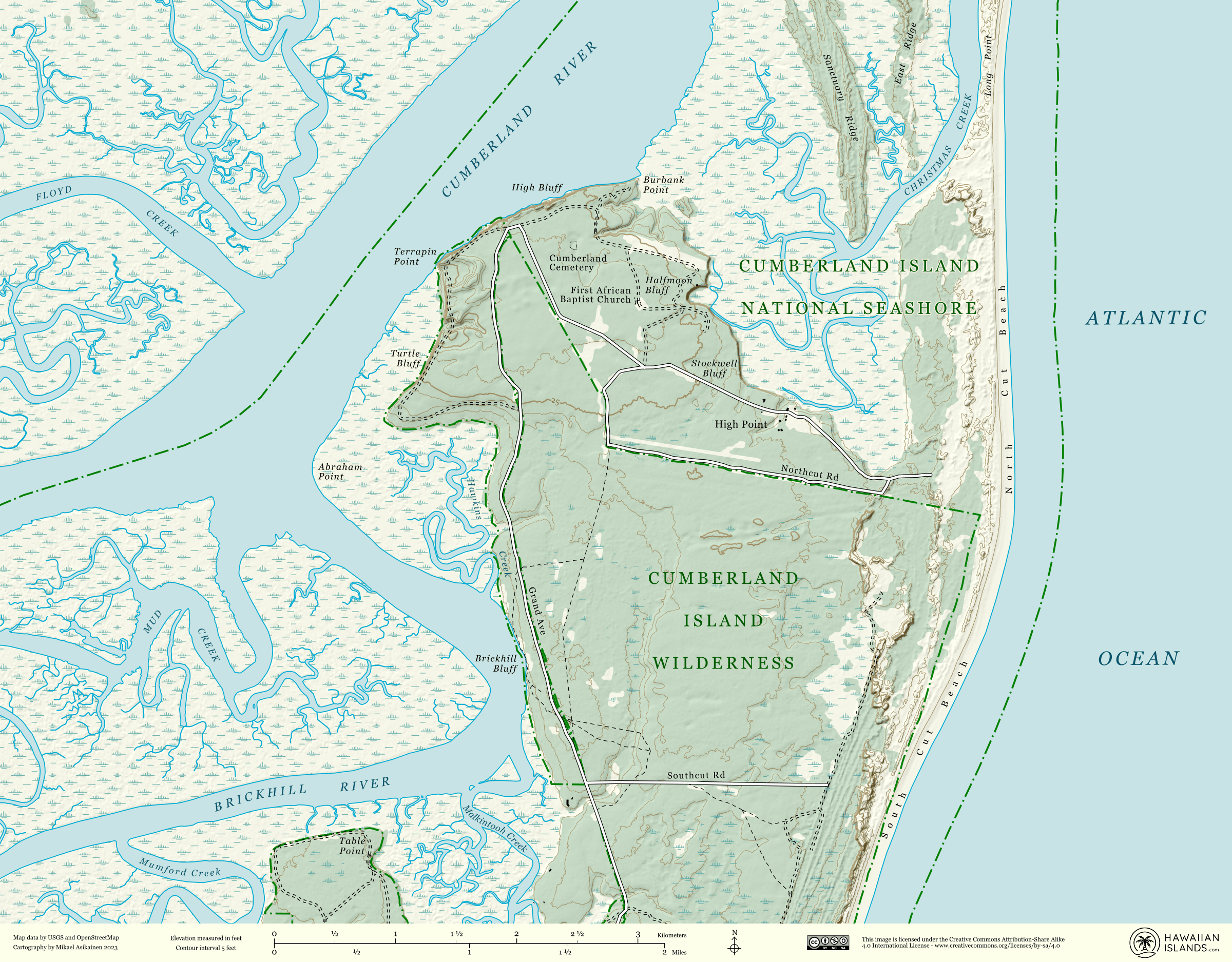
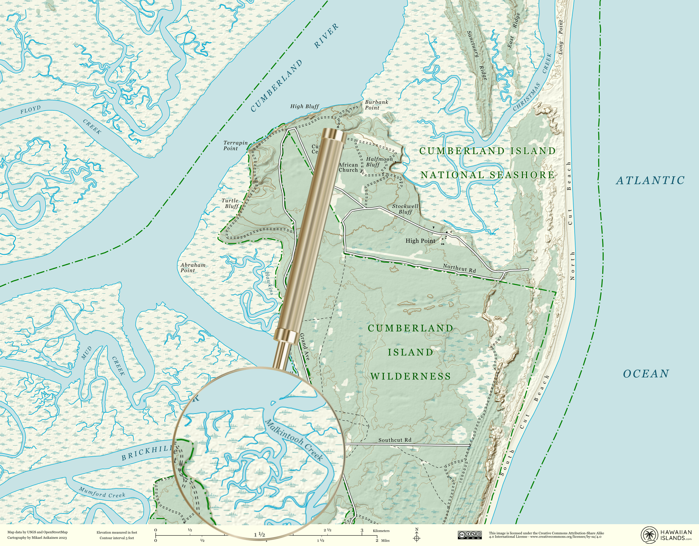
The loggerhead turtle is an integral part of the ocean's ecosystem, maintaining seagrass beds and coral reefs. The turtles nest along the Atlantic coast and Georgia's Cumberland coastline is the most important nesting location, accounting for 25 to 30 percent of the statewide nesting total.
05. Red wolf
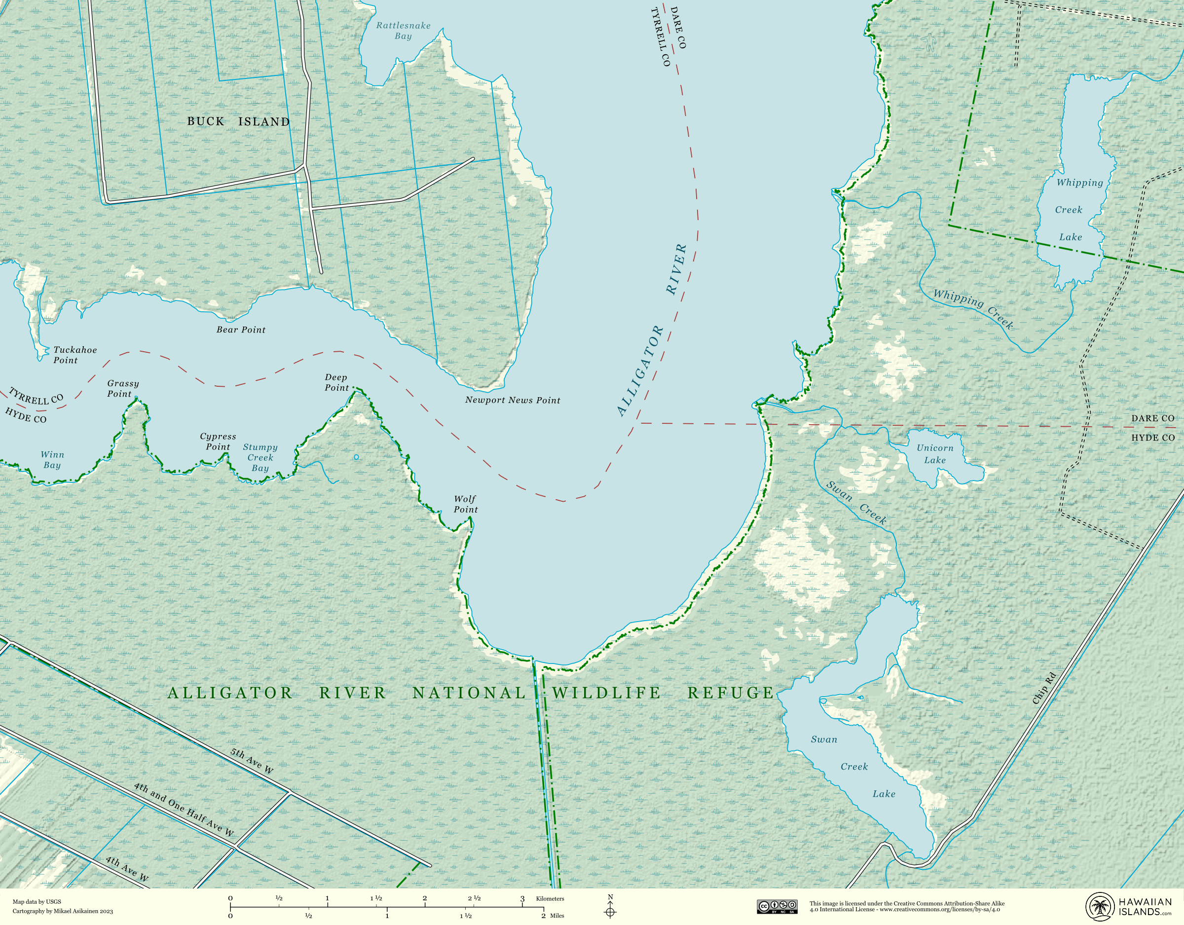
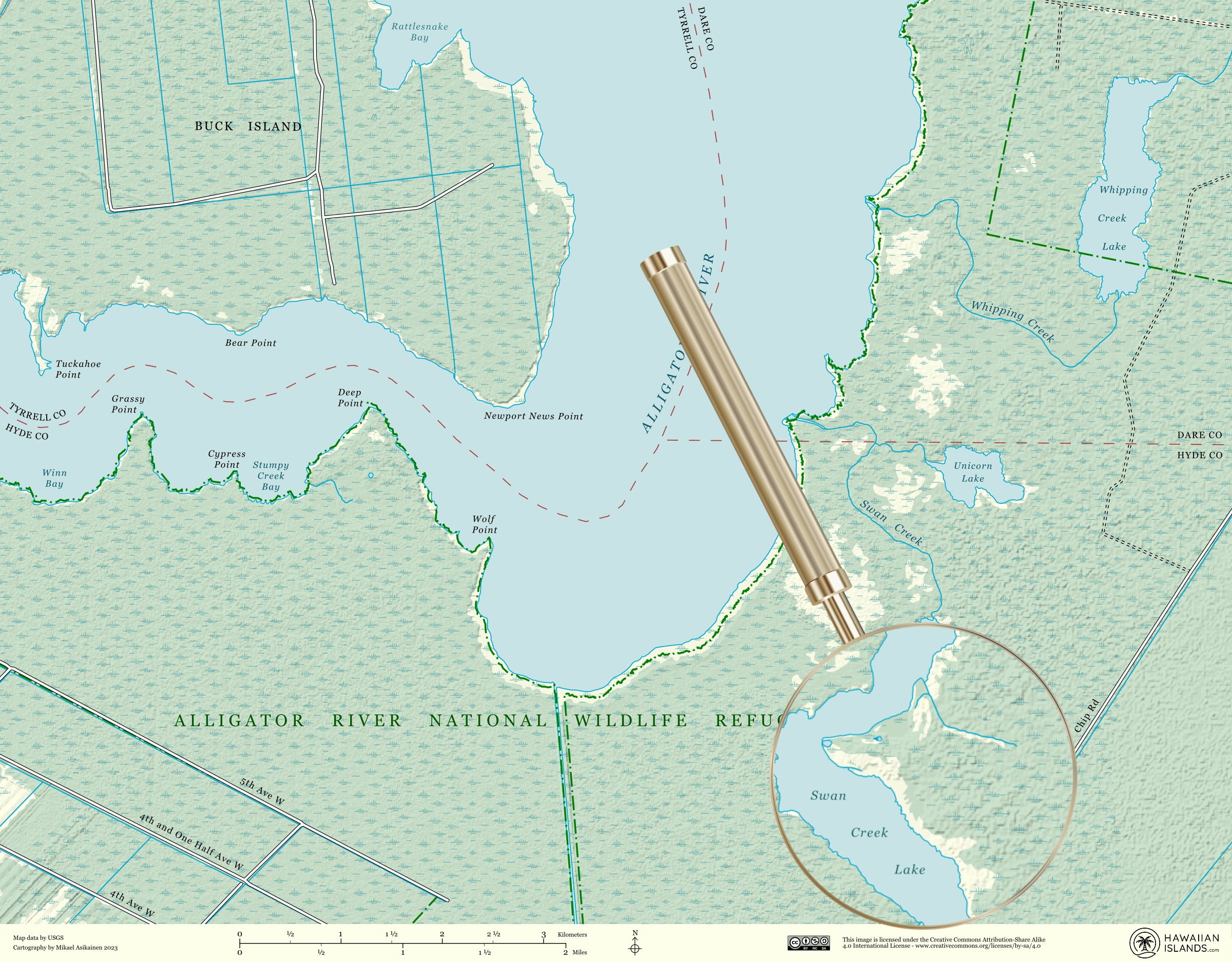
Red wolves are comfortable in a number of habitats including swaps, prairies and forests, yet despite this, it remains the most endangered species of the entire canine family. Functioning in packs, red wolves need space to survive and at present, the only wild Red Wolves can be found in the Albemarle Peninsula of North Carolina.
Daily design news, reviews, how-tos and more, as picked by the editors.
For more information on this study, take a look at Hawaiian Island's blog post to learn more about the important conservation efforts taking place to preserve these endangered species. If you're craving more cartographical content, check out this Google Maps design tweak that you probably didn't notice.

Natalie Fear is Creative Bloq's staff writer. With an eye for trending topics and a passion for internet culture, she brings you the latest in art and design news. Natalie also runs Creative Bloq’s Day in the Life series, spotlighting diverse talent across the creative industries. Outside of work, she loves all things literature and music (although she’s partial to a spot of TikTok brain rot).
